About ISAMM
The Institute for Spatial Analysis, Modeling and Monitoring (ISAMM) will bring Humboldt State University to the cutting-edge of geospatial technology. The Institute is an outgrowth of the University's geospatial program, and will serve to provide geospatial services to HSU's graduate students and faculty on a variety of research endeavors. Focusing on advanced geospatial modeling and monitoring techniques, and data acquisition via unmanned technologies, the Institute is a tremendous asset to researchers at the HSU.
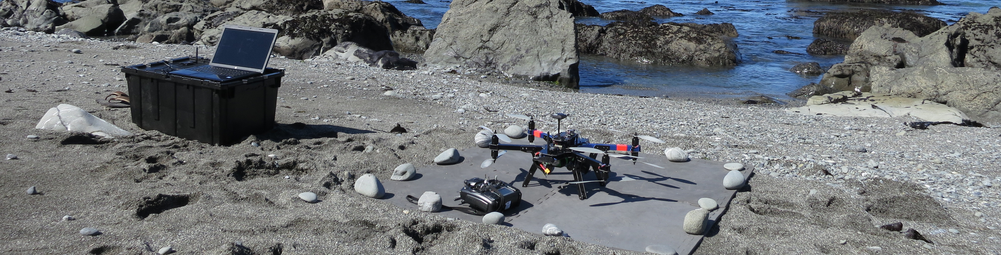
Humboldt State University is among the first of the California State Universities to explore the use of UAS in natural resource applications. The University is defining the legal structure and safety protocols required to incorporate this cutting-edge technology into its research endeavors. Over the coming months, HSU will be building out its UAS capabilities, developing a training program, and generating appropriate documentation to ensure that the University's UAS program complies with all rules and regulations defined by the Federal Aviation Administration.
|
 |
Geospatial Science at HSU
At Humboldt State, the geospatial science program is maintained within the Department of Environmental Science and Management, and much emphases is placed upon the application of geospatial analysis in natural resources conservation and management. The University is committed to furthering the breadth and depth of its geospatial courses and offerings, and actively develops news geospatial solutions to further educational opportunities. ISAMM is one example of the University's ongoing commitment to nurture new generations of scientists prepared to tackle the most pressing environmental issues of the 21st century.