3D Map Tutorials
CanvasMap supports 3D maps in the same way that it supports 3D maps so much of what you have already learned will apply. However, 3D is much more complicated than 2D because it not only adds an additional dimension (up and down) but also adds lights, textures, and other exciting features.
Three dimensional (3D) maps create more realistic renderings and allow more flexiblity and features than traditional 2D maps. 3D maps also are a bit more complicated as there are three dimensions to deal with and there are also lights, extrusions, and other features. CanvasMap was created to support 2D and 3D maps in a very similar way.
Note: The 3D extension to CanvasMap is still in alpha testing.
Examples
The following examples are available for 3D maps:
- Simple 3D Map
- Extrusion Options
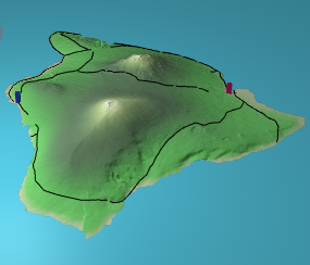
- Hawaii in UTM Zone 4 North
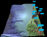
- Mount Saint Helens before and After the Eruption in UTM with text
Examles in development:
- UTM
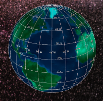
- Spherical
- Robinson
- Editor
- Graditules with text - slow to render
Code
The code for the 3D extension to CanvasMap is available at:
 |
1. Introduction |
 |
2.Projected Data |
 |
3. Spherical Projections |