Topic: What is a GIS?
What Can I Do With a GIS?
With a GIS and spatial data you can ask spatially related questions:
- The spatial distribution of object(s) or theme(s). Example: Where is x? How is x distributed?
- The relationship between the spatial distribution of objects or themes. Example: Where is x in relationship to y?
- The association of objects or themes in an area. Example: Is there a correlation between the distribution of x and the distribution of y? Could x be causing y?
GIS is About...
- Acquiring Spatial Data - representing things on the earth
- Evaluating - making sure data fits its use
- Analysis - turning data into information
- Cartography - the creation of maps
- Dissemination - distributing maps, data, and results
- Documenting - ensures future use
GIS Resources
- There are many resources:
- The web, classes, books, organizations, individuals
- See Jim's professional website for more:
- You'll want to know everything on the "Quick Reference"
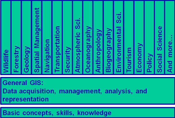
The Bigger Picture

GIS is almost everywhere...
Key Points
- A GIS is not just a computer program for making maps
- It is, first and foremost, a powerful analytical tool with a spatial "awareness" that allows you to analyze spatial data and answer complex spatial questions.
Test Your Knowledge
Lab 1 >