Jim's office hours:
Nick's office hours:
Please contact us by email to make an appointment or by phone you cannot make these times or have an urgent issue.
From the catalog: Introductory course in Geographic Information Science and spatial analysis involving collection, manipulation, display, and analysis of geographically referenced data. Raster and Vector data, overlays, buffer, proximity analysis and SQL queries.
Prerequisite: GSP 101: Geospatial Concepts or equivalent. To do well in the class, you'll need:
Purpose: The key purpose of this course is to see that you become someone that could be hired (i.e. get paid) to complete a small GIS project from start to finish. The course follows the steps you'll tyically take in a GIS project and has you create a series of GIS reports for this purpose.
This class will cover everything from acquiring data through producing final, publishable products that contain spatial data (maps) and analysis results (tables and graphs).
The lectures and labs for GSP 270 are based on common, general GIS tasks geared toward a diverse audience of students. The specific data you use may be outside your area of interest, but the knowledge you gain and the skills you'll learn can be applied to any spatial field.
The class covers the concepts behind GIS and touches upon cartography, remote sensing, and the use of GPS handheld. GSP 370 is a natural follow-on to this class and will go into more detail in the concepts behind GIS and additional analysis techniques. Please see the other geospatial classes for additional learning opportunities.
By the end of this course it is expected that you will be able to:
The class elements are organized into "Learning Modules" where each module covers a single topic in depth. The modules include:
All of the learning modules are on this web site under the "Calender". Each week, you'll want to read ahead to the next learning module so you can start the reading and activities for the next week.
In addition to the learning modules, there will be:
The readings are critical to covering the full depth and breadth of knowledge in GIS. Please make sure you read the assigned readings each week before the first lecture session. The regular lecture material has been replaced by online material including videos by the instructors and students.
There is a discussion board for students to interact with the instructors and each other. The discussions can be invaluable for students that are struggling with the labs. This you may do well in one lab, and then struggle on the next, it's good idea to particiapte i the discussions and hlep out others when you can. Students are expected to review the online material and participate in discussions each week.
I believe the best why to learn GIS is by doing. Thus, the labs are really the core of this class. The readings, lectures, and discussions will give you the knowledge, information, and probably solving ability to tackle just about any GIS task that can be tackled. If you have problems, please raise them on the discussion board. You'll be surprised how many other students have the same problems.
There are activites you can do on your own in the learning modules. If you know of other activities the class might find interesting, please let the instructor know.
The quizzes will focus on recent material covered in class and in lab but will also include previous material, particularly concepts that students are struggling with. This is to both help reinforce the important concepts in GIS and to provide feedback to student and the instructor to help improve the class.
At the middle of the term, you'll start on a small GIS project and will create a professional, final report. See the Project web page for more information.
TBA
We'll be using the Canvas Learning Management System hosted by Instructure (https://humboldt.instructure.com). You should receive an invite to join Canvas at the start of the course. After you login, follow the steps below to find the first items for the class:
To use Canvas:
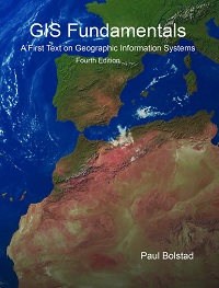 |
GIS Fundamentals by Bolstand is recommended for the class. The key content from the book has been moved online but we expect you to read the corresponding book sections and/or investigate each topic in other ways including the Web. |
Below are the weights for each of the graded elements of the class:
Labs and Projects will be each be graded from 0 to 100 points while quizzes are worth 10 points each. The overall lab score will be computed by adding up the points from all labs and dividing by the number of labs during the semester. The overall quiz score will be completed in a similar way. Participation points will be deducted for not participating in discussions.
Your final grade will be determined by using the Percent Grade to find the letter grade based on the ranges below:
The scores may be curved if needed.
Canvas will be used to post results of labs and tests as they are graded but letter grades are not assigned until the end of the term.
To do well in this class, you'll need to make sure you review the online material and complete the assignments on time.
The labs are due at the end of each week on Sunday at midnight. Students are constantly trying to fix something in a lab before they turn it in and then miss getting started on the next lab. This can lead to you falling further and further behind. There will be 10% off automatically for labs that are late by even a few minutes. Then, another 10% will be removed for each additional day the lab is late.
Assignments can be turned in late without deductions if you have an excused absence. Excused absences must be accompanied with appropriate documentation. Examples:
Extra credit is always available. You can gain one overall grade percentage point by just attending a seminar that includes spatial content and writing up a short (one paragraph) summary of what was presented. You can gain another point by writing up another paragraph with your constructive criticism of the content.
This is an online class and that makes the class time more flexile but it also requiers all of us to work together to make the class effective. Please remember to:
Adapted from: http://teaching.colostate.edu/tips/tip.cfm?tipid=128
GIS is best done as a team sport and you are highly encouraged to seek help from your fellow students and just about anyone else. At the same time, you are responsible for your work and must complete each assignment independently. You can copy material from web sites and other sources in many cases but you must cite the sources properly.
You can help each other but do not include any material (i.e. files) from other students in the class in your work. The one exception is your final project where you can exchange files with the other members of your team.
If you cheat on an assignment or a test, you will be given zero credit for that task. If you cheat multiple times, you will be given a grade of "F" for the class and asked to stop attending.
Note that for your labs, we always put a "turn-in" sections at the bottom of the page so they are easy to find.
To be successful in the class you need to:
You will need to spend about four hours a week revewing material and three completing the lab assignments. Sometimes the labs will take quite a bit longer when you get "stuck".
I can only cover a small portion of the exiting and growing world of GIS. I encourage all of you to find additional resources on GIS within your area of interest. The Internet is a great way to get started to see who is out there in the GIS world and what they are doing.
All of us have things we are good at and things we struggle with. Being a GIS professional requires a variety of knowledge and skills. This includes being able to connect with the outdoors, to working effectively with computers, and communicating results to a diverse audience. When you find something that is hard for you try some of these techniques and then look for more that I can add to the list:
If you have a dissability that effects your ability to be successful in the course, please contact me, or Nick, and we'll do our best to accomodate you. Please don't wait to contact us as we want to make sure you can keep up and we're happy to accomodate you.
© Copyright 2018 HSU - All rights reserved.