Having missing or incorrect spatial references can cause major problems for analysis and cartography. ArcMap includes a feature called "Project on the fly" where it will try to project data sets to the same spatial reference. This sounds good but creates a whole series of other issues. If all the data sets loaded into ArcMap have the correct spatial reference, everything is fine. However, if one has a missing or incorrect spatial reference, ArcMap will still display the data, just in the wrong place.
Let's take the following examples, I've taken a boundary file for Humboldt County that was in UTM Zone 10 North WGS 84. For one file, I removed the spatial reference (just delete the PRJ file) and for another I've changed the spatial reference to Geographic WGS 84. Watch what happens when we load each of these into an empty data frame (i.e. select "File -> New" before loading each one) in ArcMap. Especially note the coordinate value and units in the lower right.
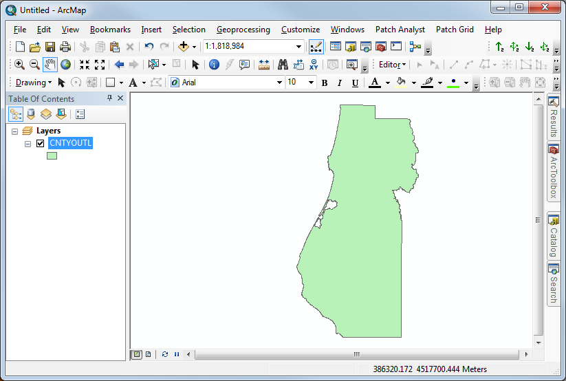
Figure 1. Humboldt County properly referenced as UTM
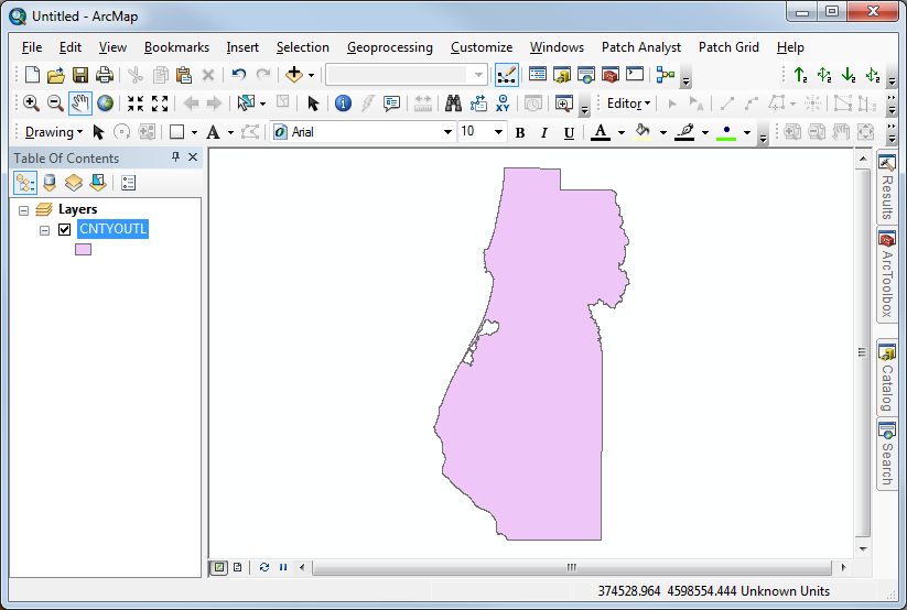
Figure 2. Humboldt County in UTM Zone 10 North, WGS 84 but without a spatial reference. In this case, ArcMap will have popped up a dialog letting you know the data set had an "Unknown Spatial Reference" and down at the bottom you may notice that the units are "Unknown Units".
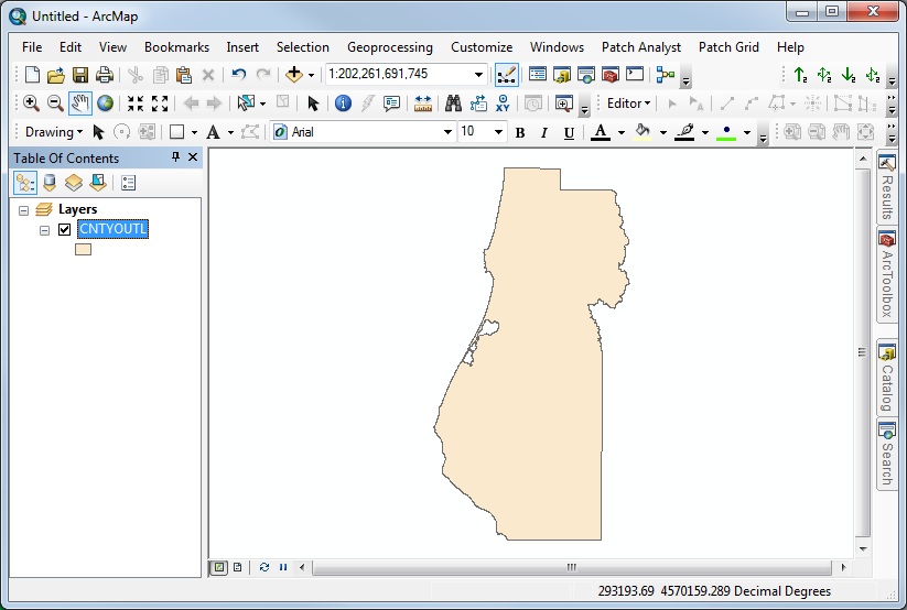
Figure 3. Humboldt County with an incorrect spatial reference. Note that the coordinate value is huge (because it is actually a UTM coordinate) and the units indicate "Decimal Degrees". Also note that I did not get an error loading this data.
This shows that it is very easy to have a missing or incorrect spatial reference and ArcMap will never recognize it - you have to!
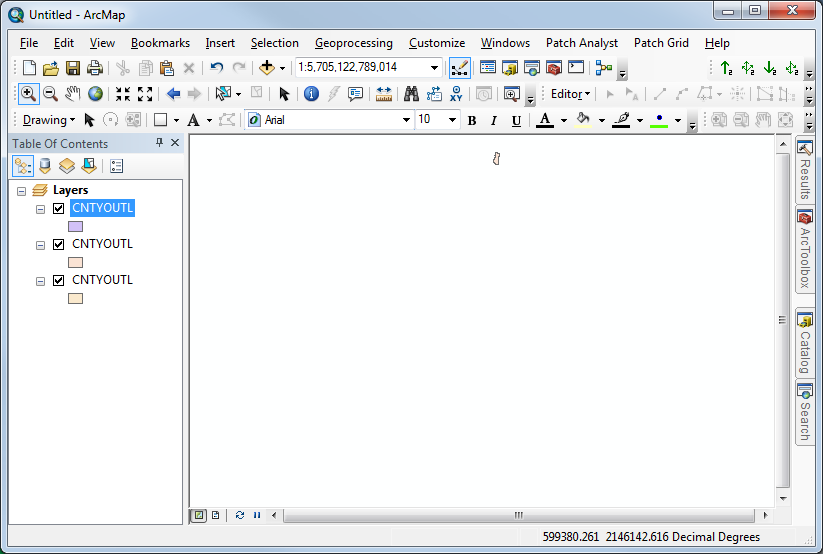
Now, let's load all the data sets into ArcMap together at the same time. Then, click on the little earth button to zoom to see all the data sets. You may have already seen a window like this and you probably will in the near future. There is a tiny Humboldt County at the top and there is actually one that is so small it is invisible at the bottom. ArcMap is doing it's best to display all three data sets by "projecting on the fly" to put them all into the same spatial reference. When this happens, know that you have a spatial reference problem and stop and fix it! If you proceed, your results will probably be wrong and you will definitely be frustrated working with the data.
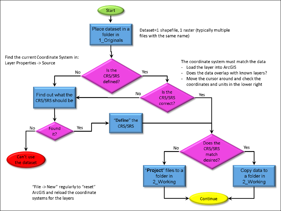
The key to fixing all spatial reference problems is knowing when to "define", when to "project", and when to throw away the data. The flow chart below is key to being successful with this process.
Note that the "Geographic Transformation" is only needed if there is a datum shift.
© Copyright 2018 HSU - All rights reserved.