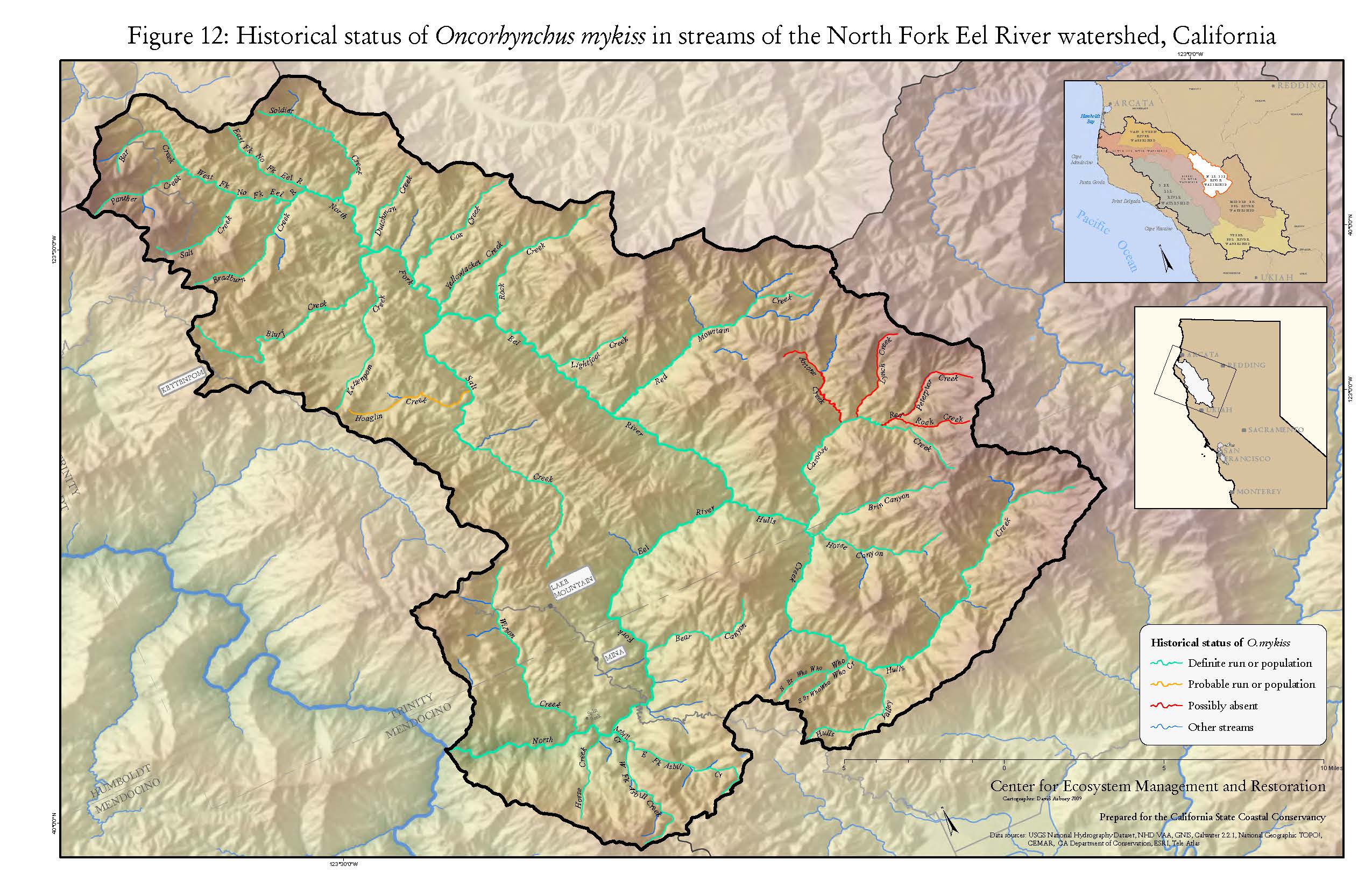
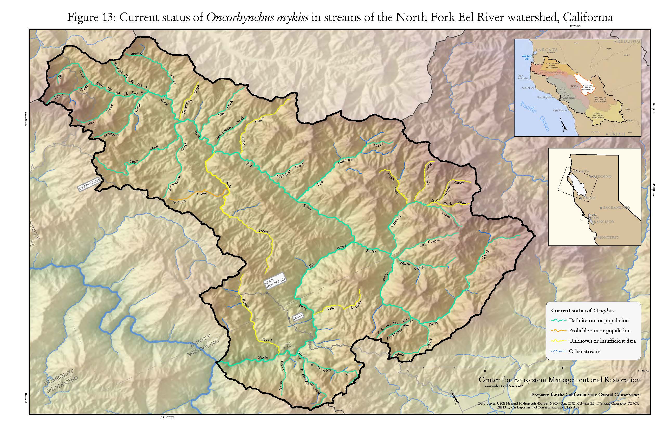
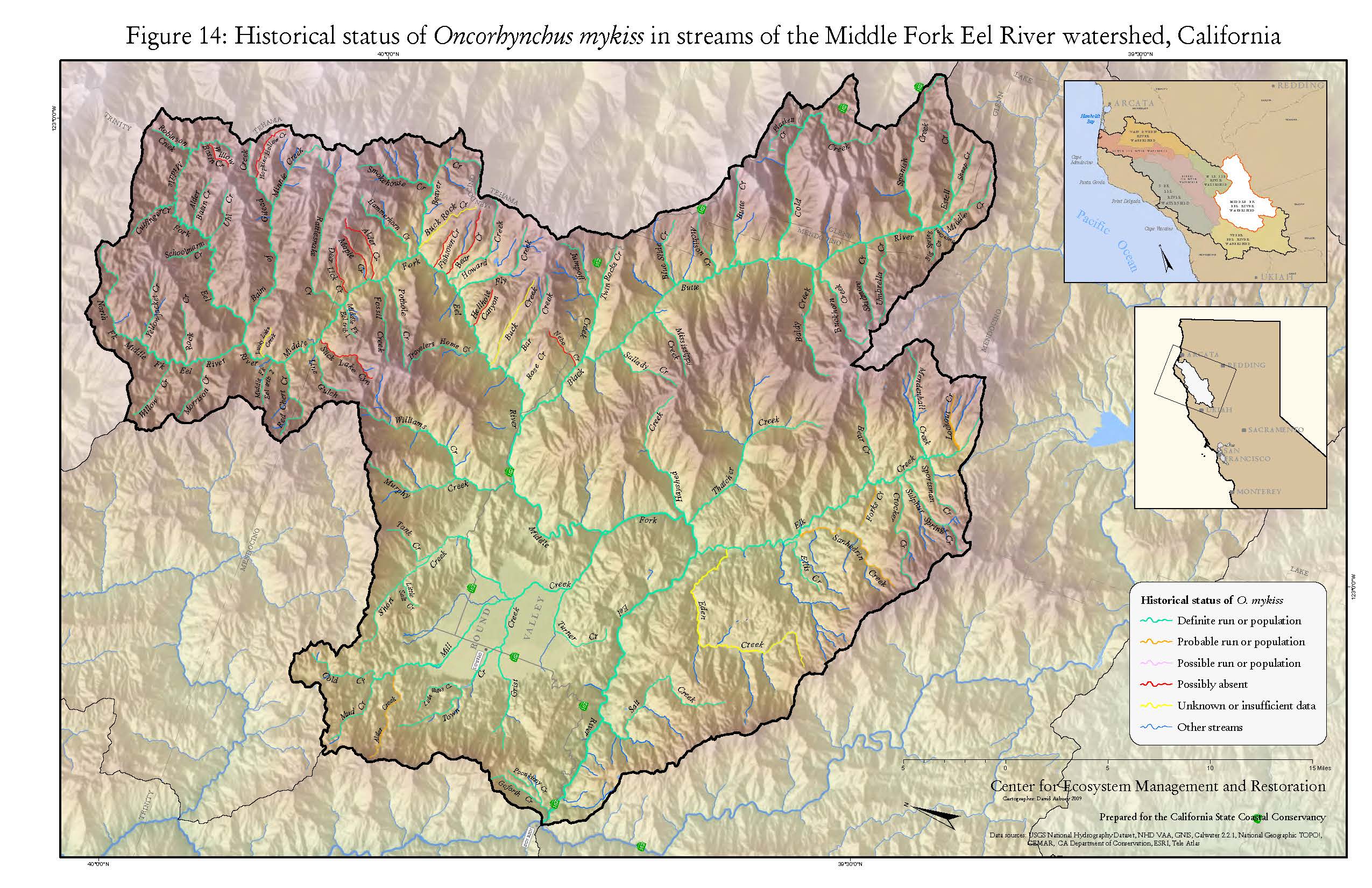
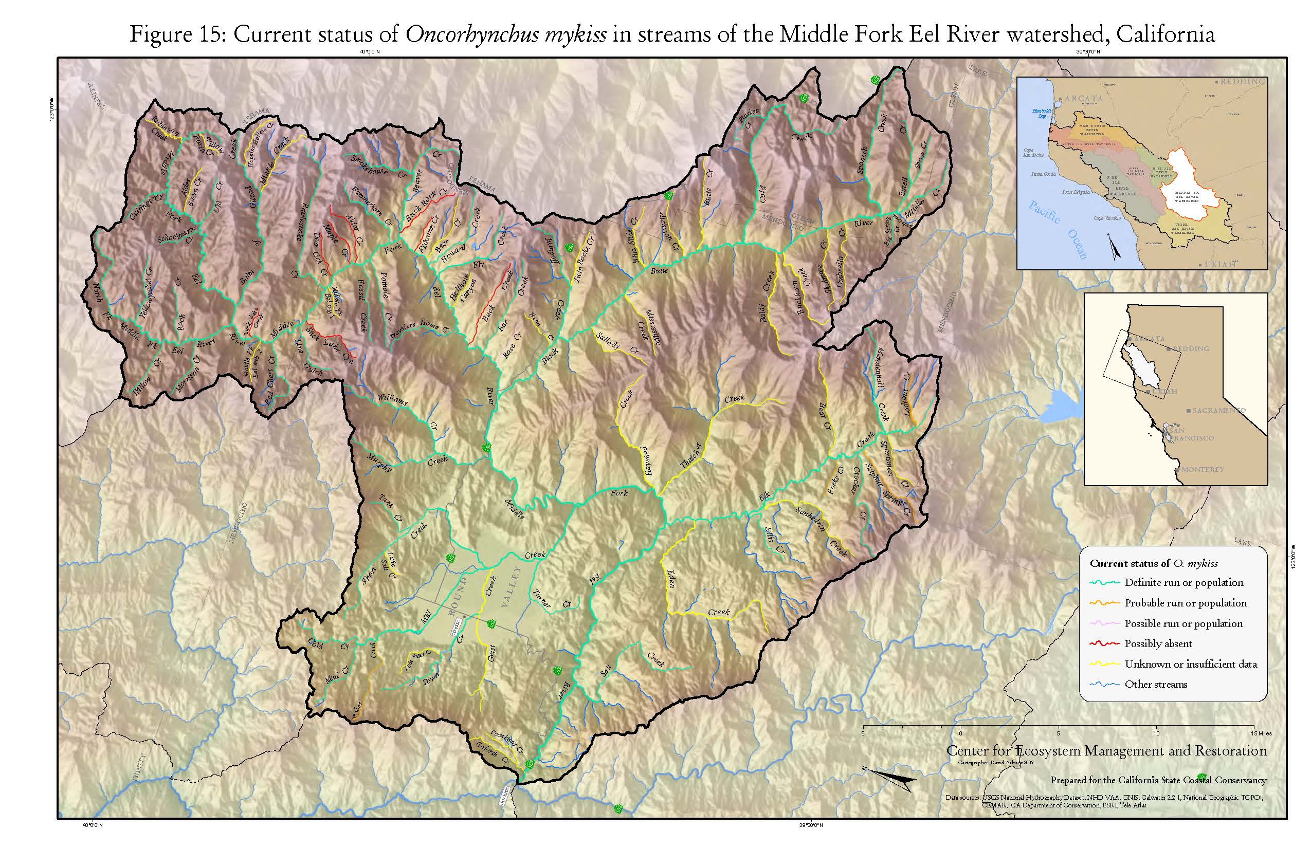
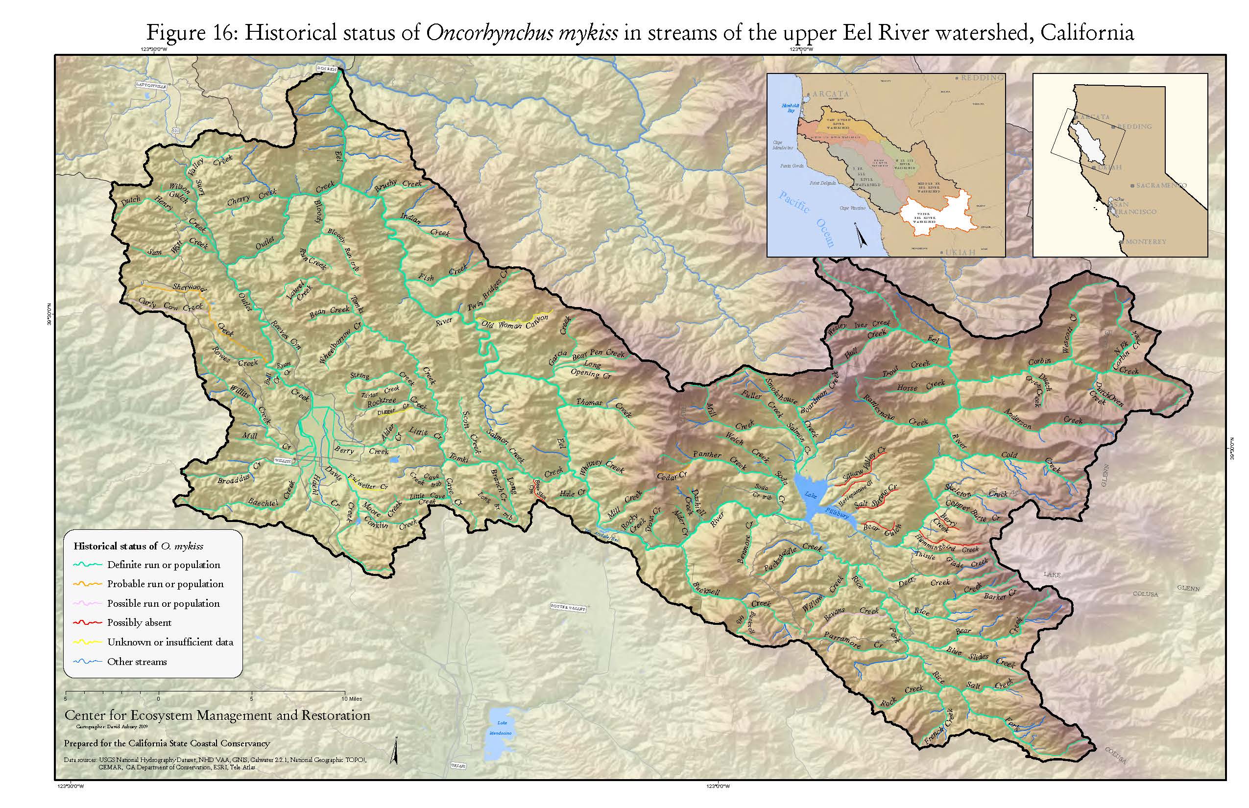
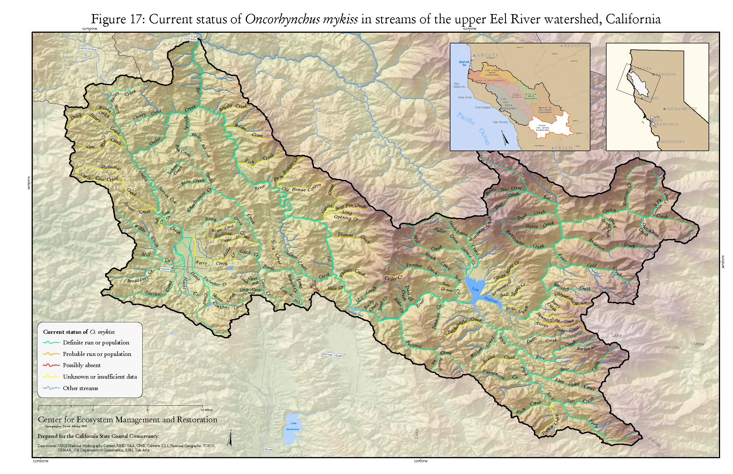
The Eel River
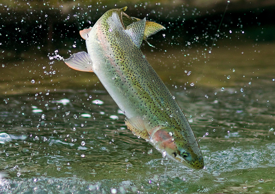
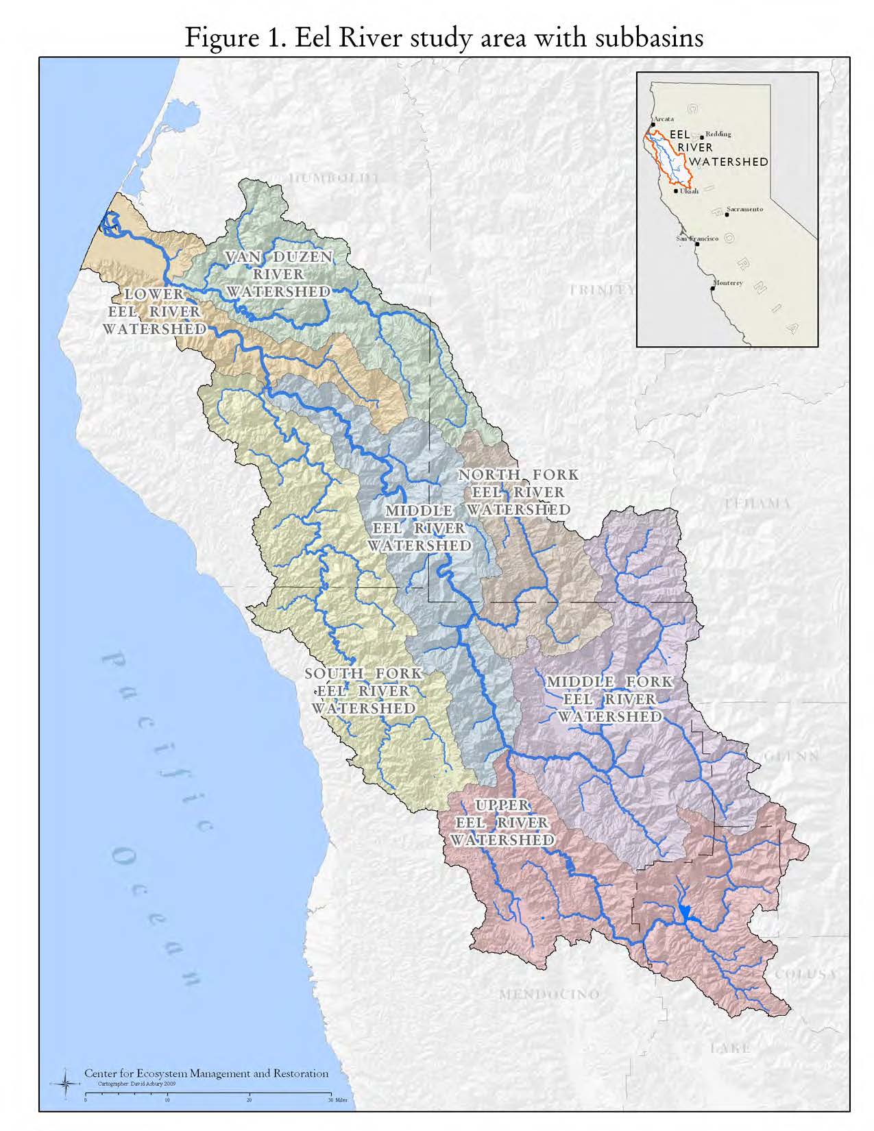
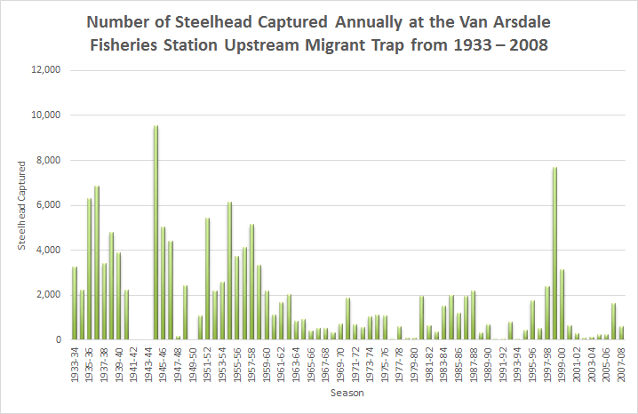
The Eel River is the third largest watershed located entirely within the state of California. It drains an area of 3,684 square miles into the ocean where its estuary creates the third largest coastal wetland in California. Along its stretch there are 2 hydroelectric dams on the Eel River - Scott Dam (forms Lake Pillsbury) and Cape Horn Dam (forms Van Arsdale Reservoir). The Eel River is home to the Pacific Lamprey, a parasitic fish that looks a lot like an eel - giving the Eel River its name. The Eel River is home to four species of salmonid: coastal cutthroat trout, steelhead and rainbow trout, coho salmon, and chinook. Other species of fish include: Sacramento sucker, threespine stickleback, Pacific staghorn sculpin, Coastrange sculpin and prickly sculpin. Since the 1850s salmonid populations have declined for a variety of reasons. Large scale commercial fishing, canning, high erosion rates, logging, grazing, and record flooding each dropped the populations of the fish that call the Eel River home. Yet there is still hope; in 2012 salmon and steelhead populations saw the highest count since 1958. With better land management practices throughout the watershed increased numbers are likely to be seen.
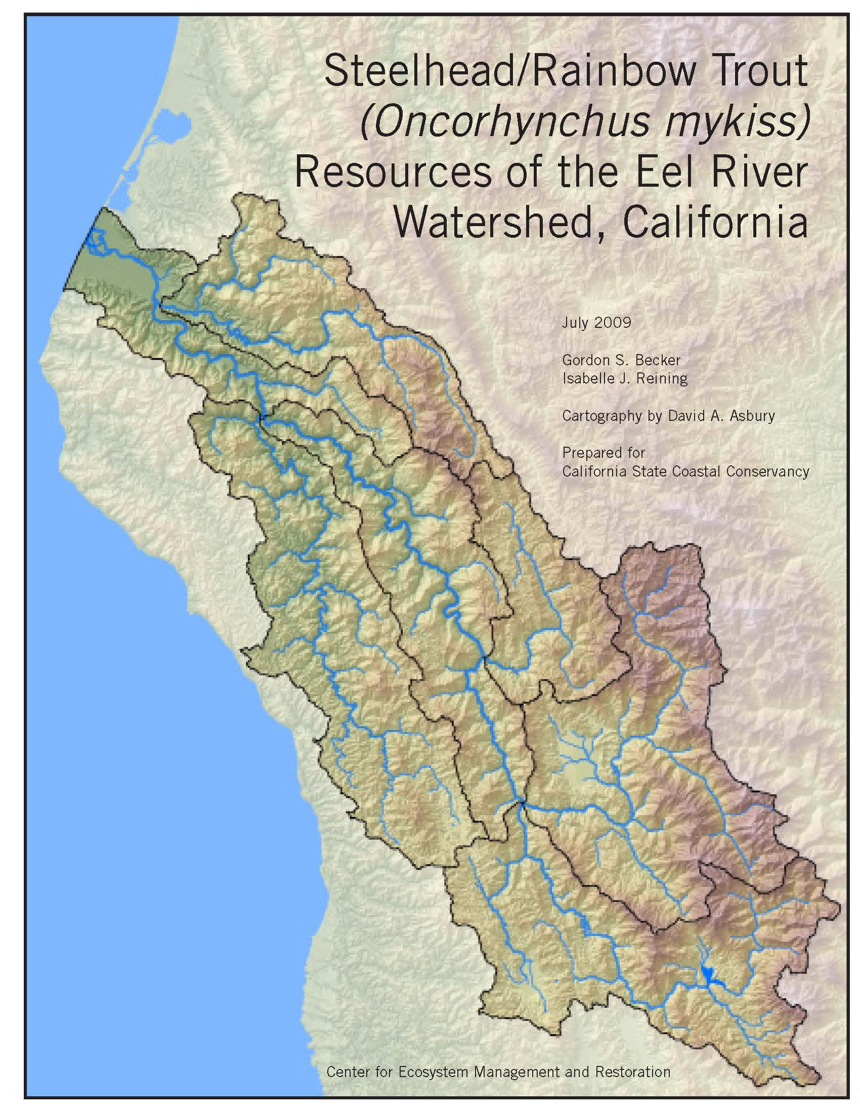
Steelhead/Rainbow Trout (Oncorhynchus mykiss) Resources of the Eel River Watershed, California
By Gordan S. Becker and Isabelle J. Reining
Cartography by David A. Ashbury
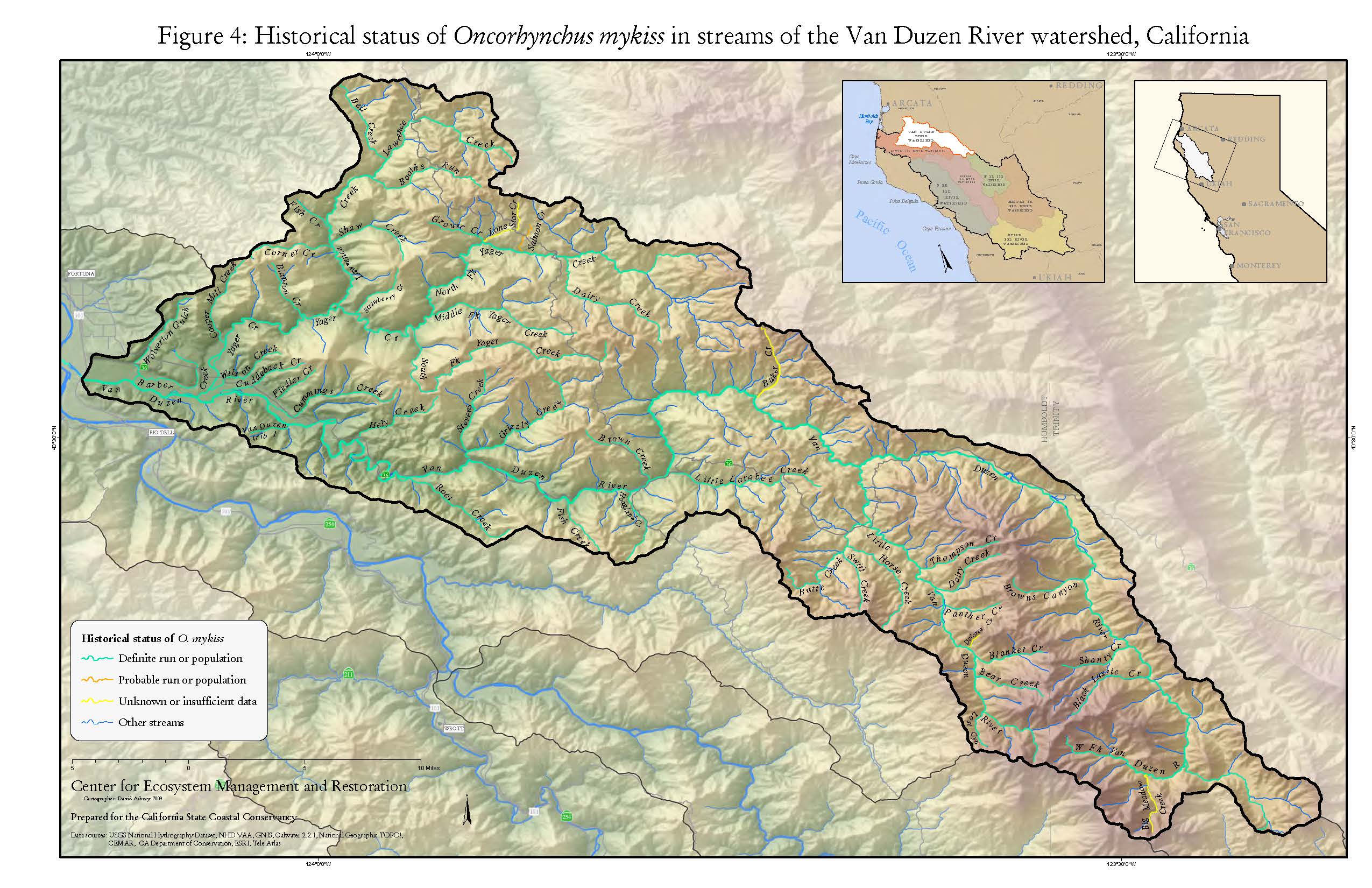
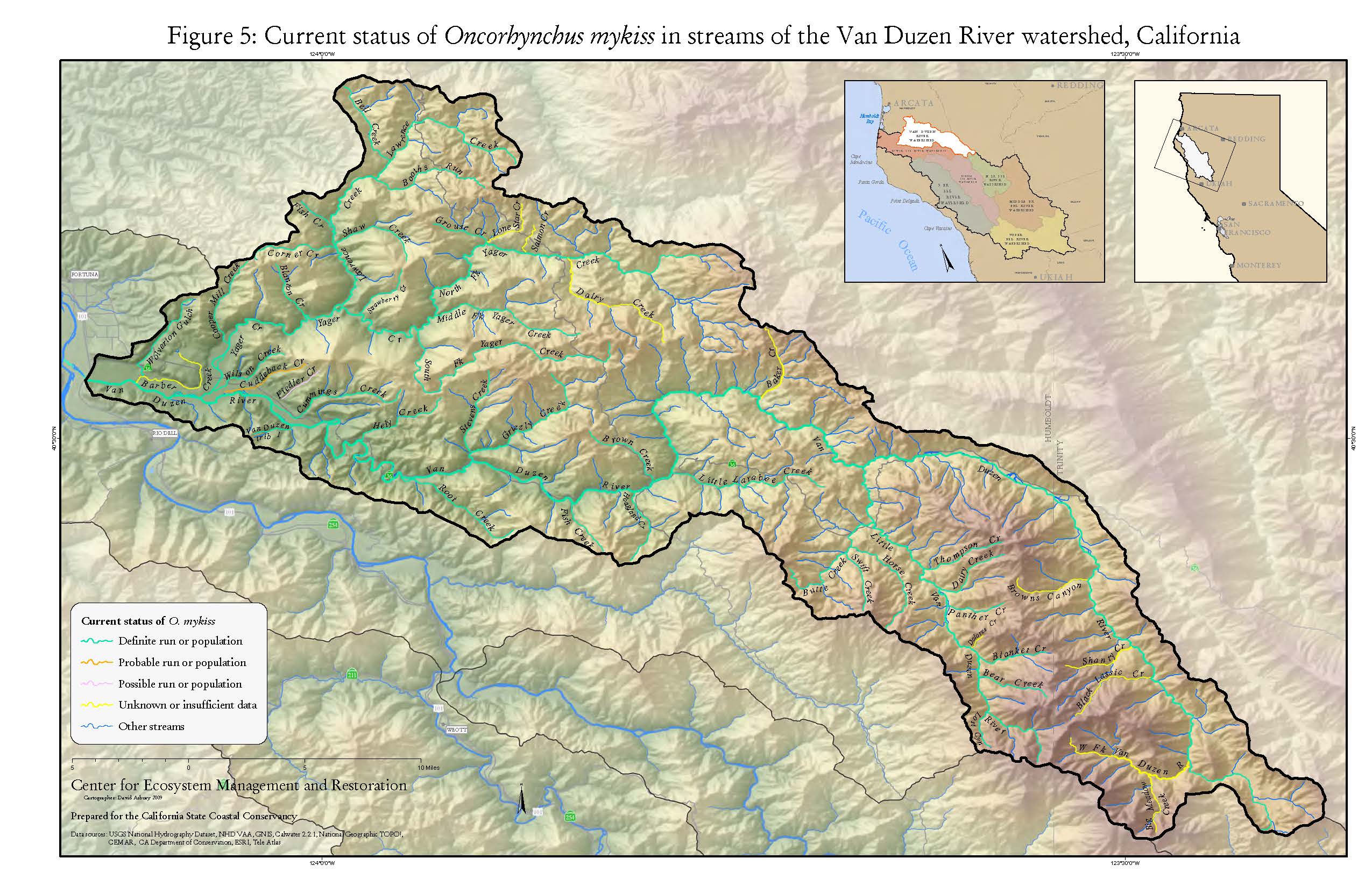
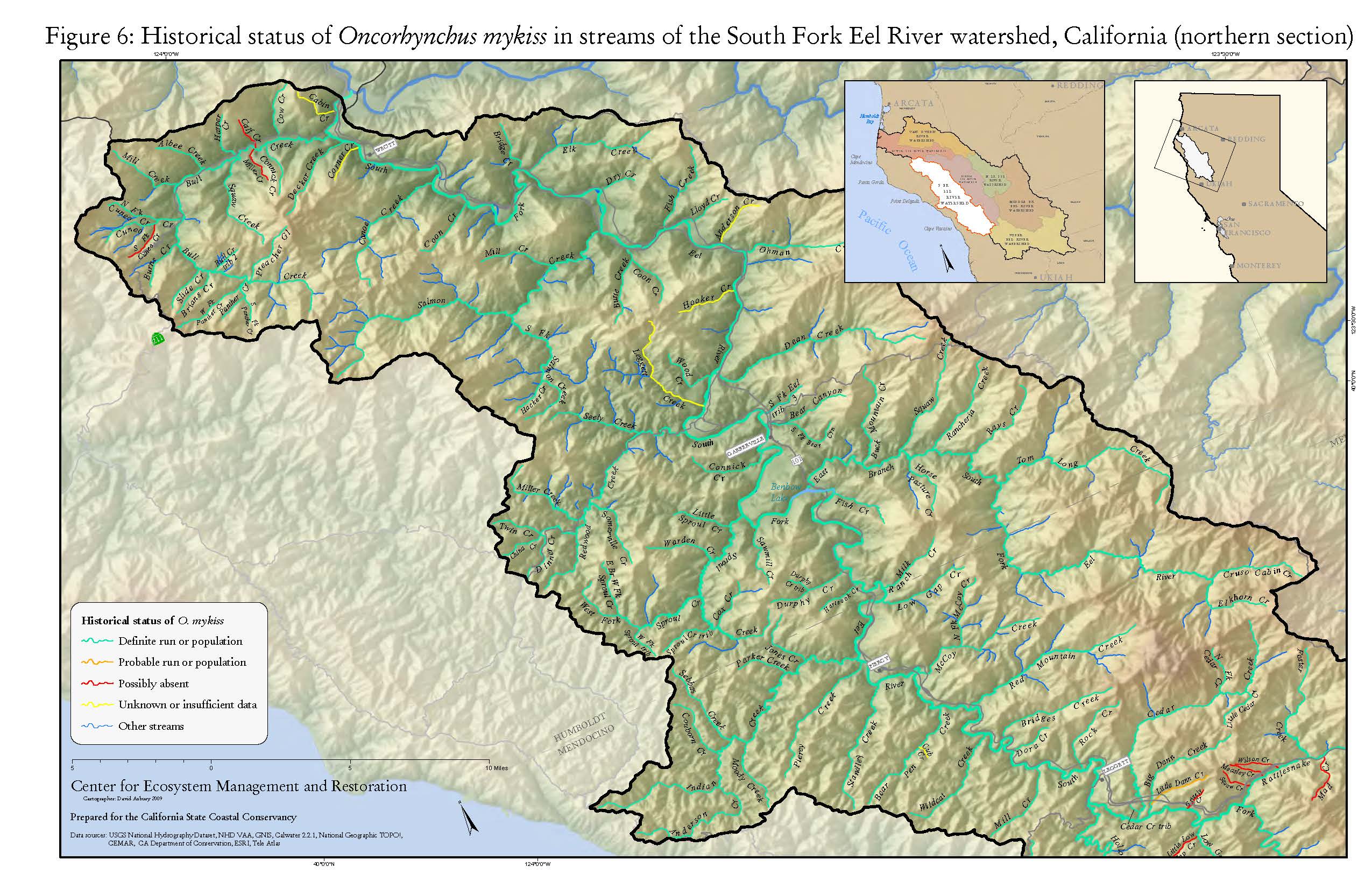
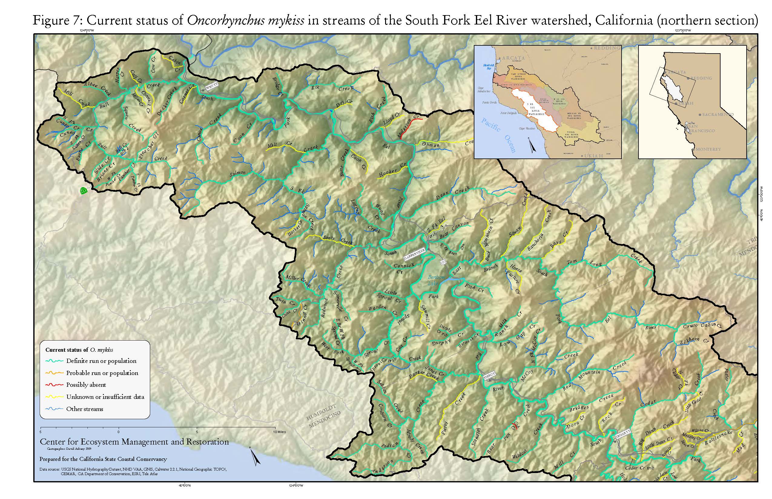
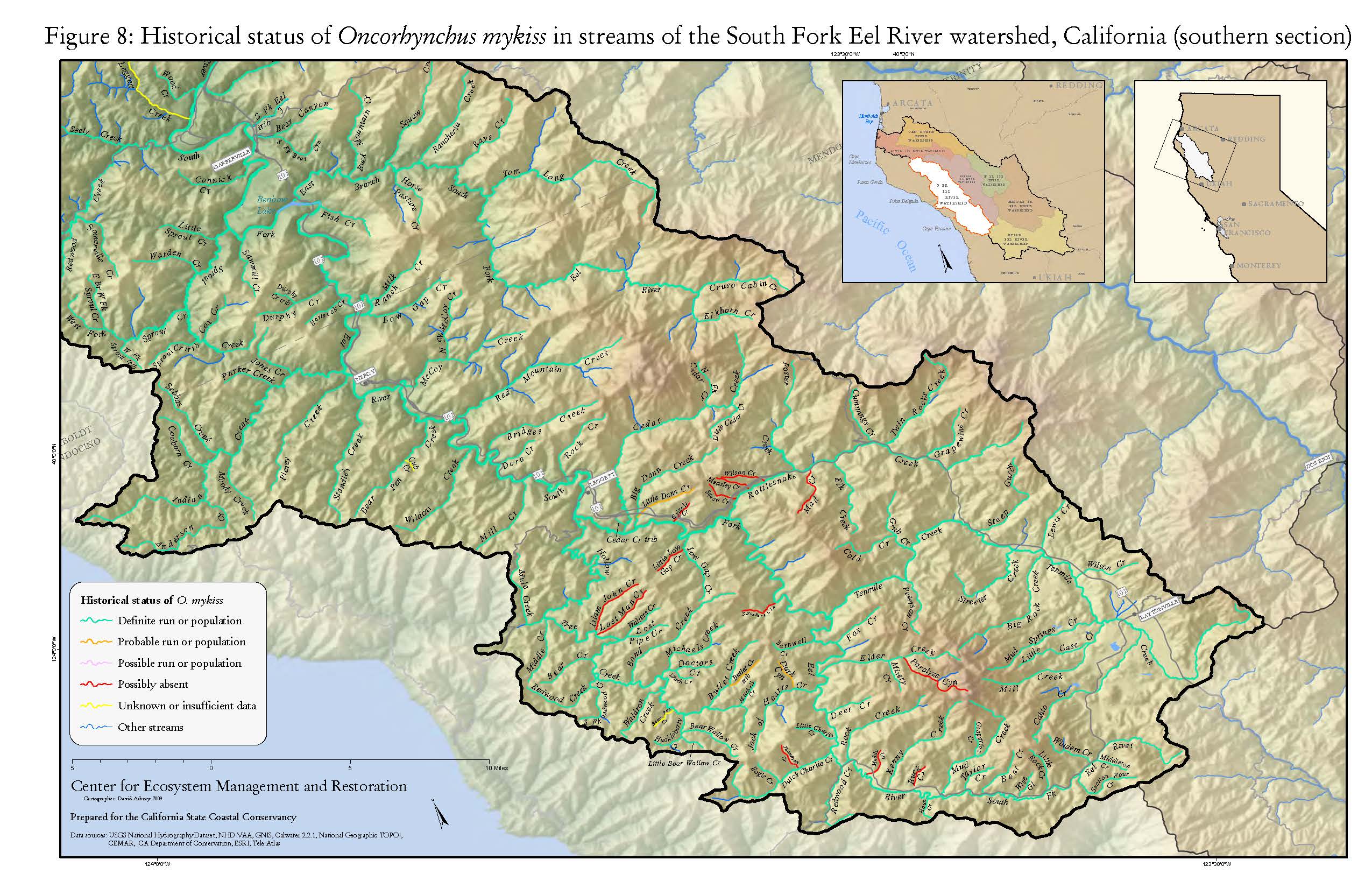
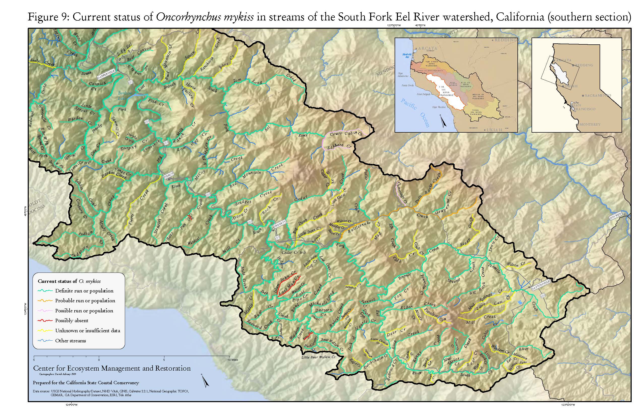
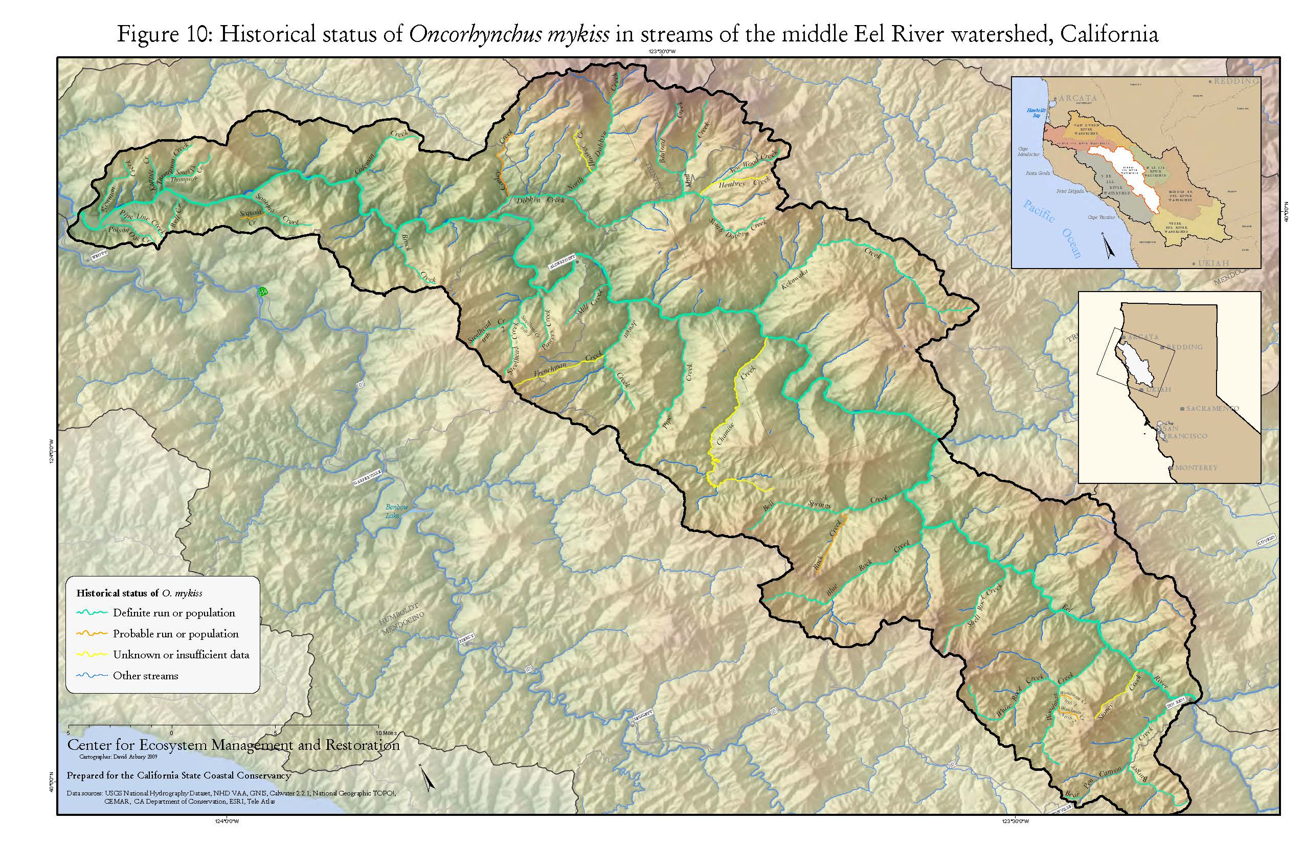
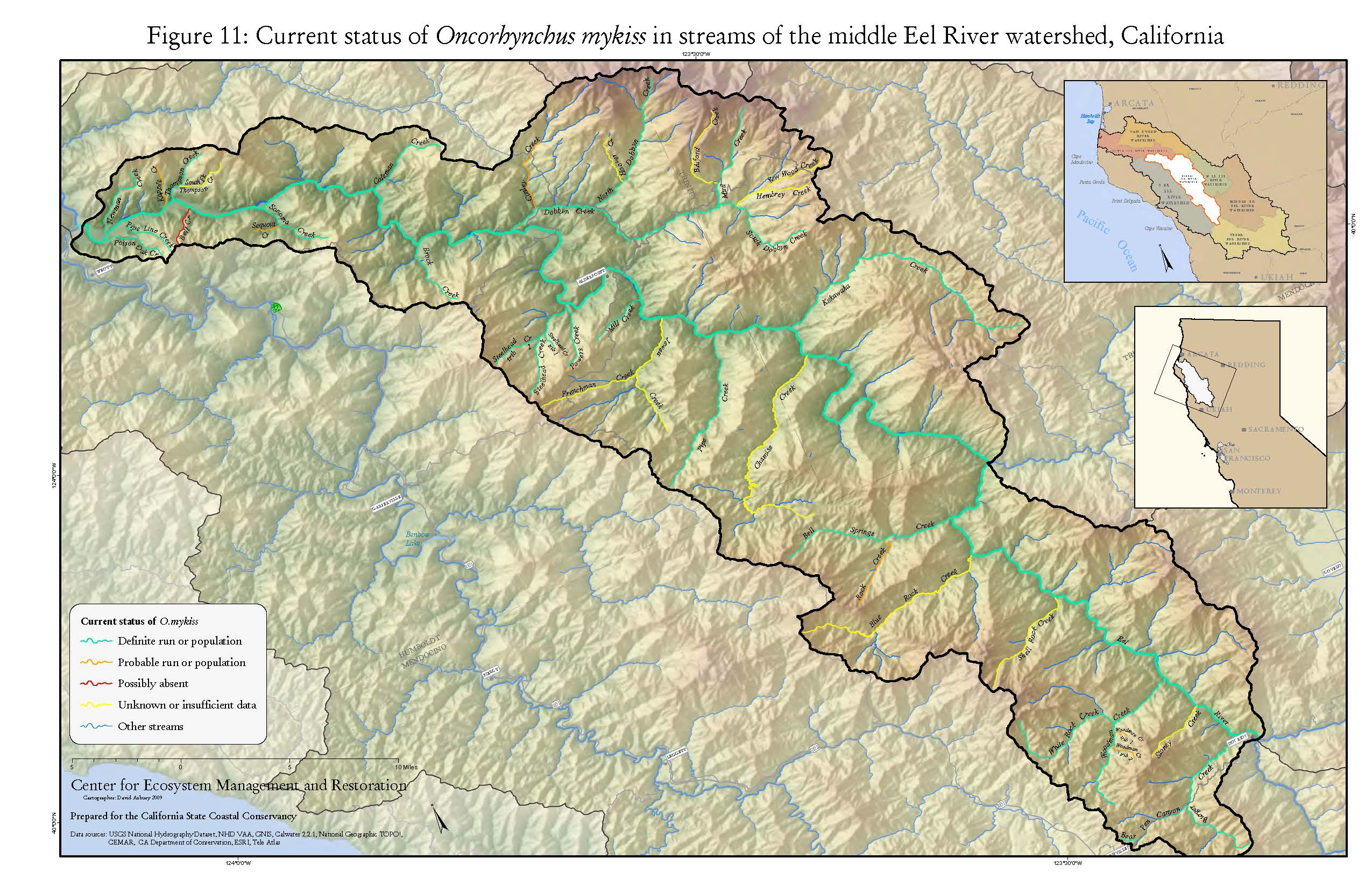
All of the following information found on this page can be sourced to a research paper by Gordan S. Becker and Isabelle J. Reining Steelhead/Rainbow Trout (Oncorbynchus mykiss) Resources of the Eel River Watershed, California
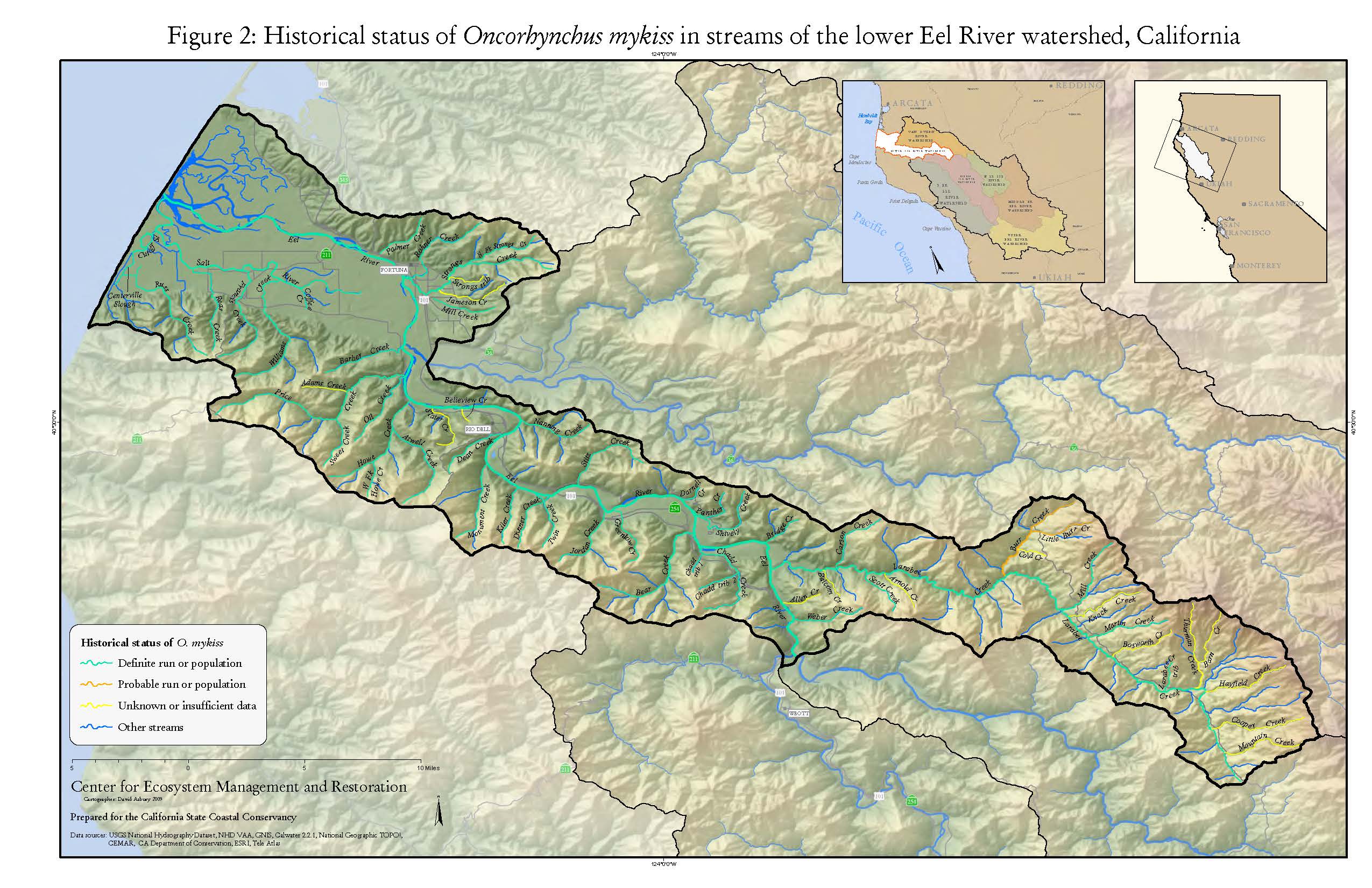
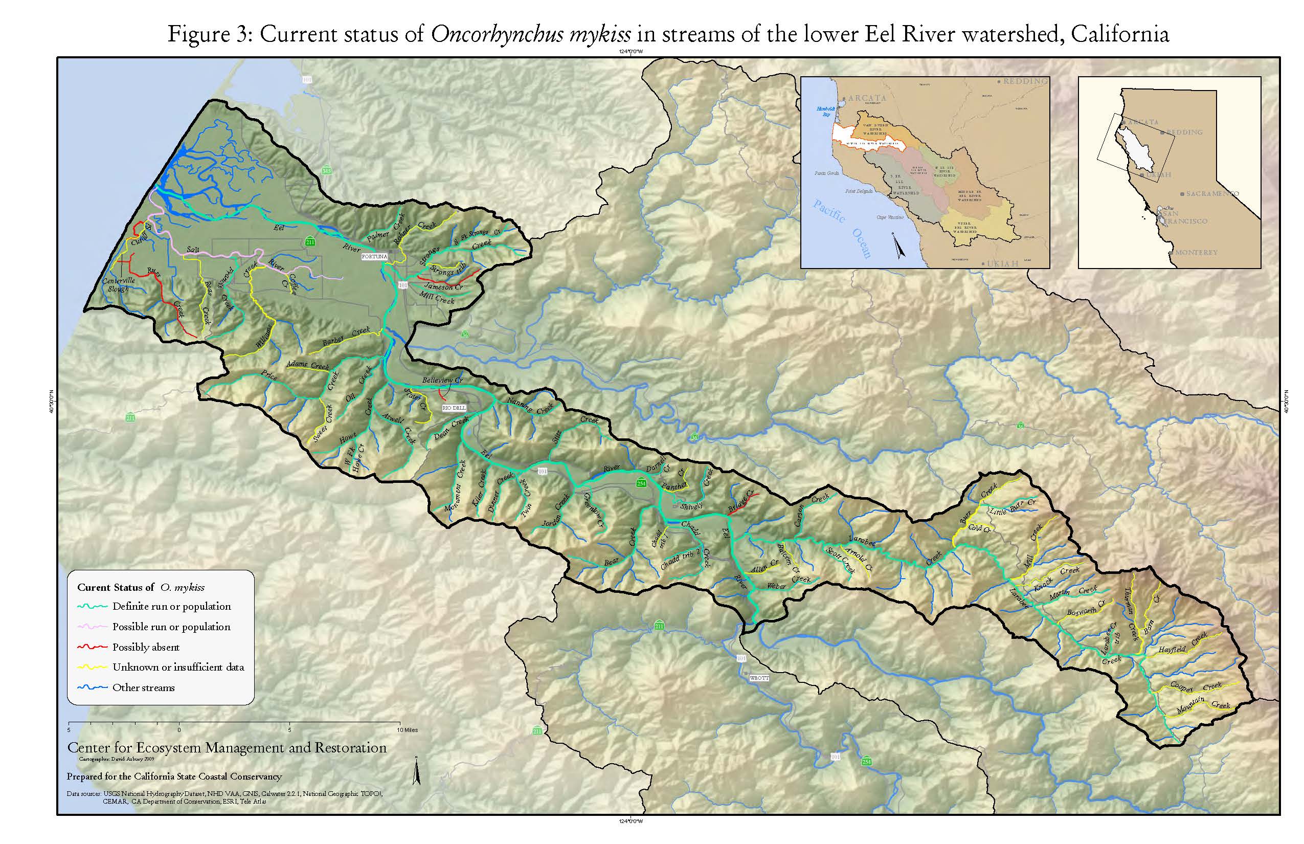
Keys for Using the Map Below
Within this map the these phrases or acronyms mean:
- Historical: before 1998.
- Current: 1994-2009 or approximately 15 years before 2009.
- DF: Definite run or population.
- PB: Probable run or population.
- PS: Possible run or population.
- PA: Possibly absent.
- UN: Unknown or insufficient information.
- Evidence of decline: Has the population decreased over time?
- Yes: Evidence suggests that a population decrease has occurred.
- No: No evidence shows any population decrease.
- No Value: Not enough evidence to discern population changes.
- Anadromy: Does the stream currently support populations?
- Yes: Reproduction is successfully occurring in the stream or in upstream tributaries. No complete barriers to ocean.
- No: A complete barrier exists between the stream and the ocean or no populations are reproducing in the stream.
- Unknown: Passage to ocean or reproduction status is unknown.
- Current Population Status: Population status from approximately 1994 to 2009.
- 0: Absent or unknown.
- 1: Individuals observed.
- 2: Some evidence of reproductions.
- 3: Evidence of regular reproduction.